
Your Eyes
In The Sky.
Actionable site intelligence for better project cost control. We survey your site from the air, walk every flat in progress on the ground, and put independent evidence on your screen within 48 hours.
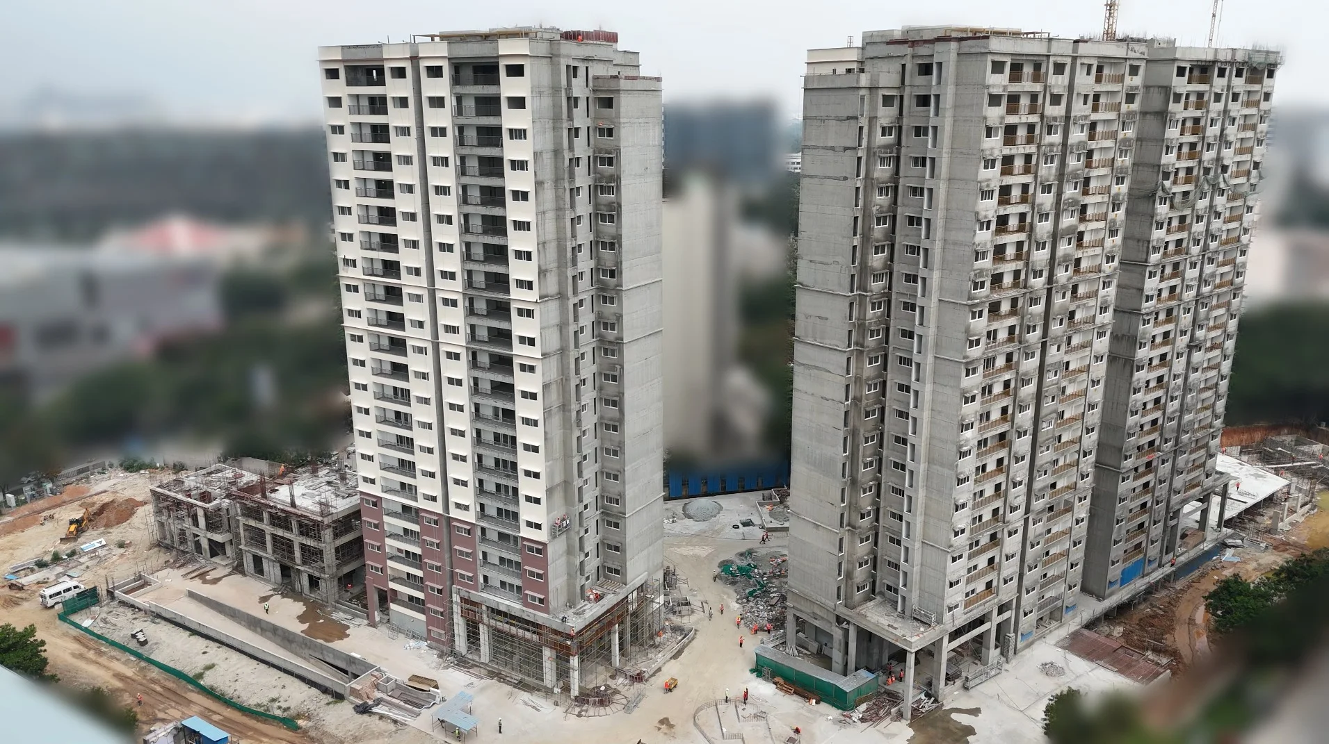
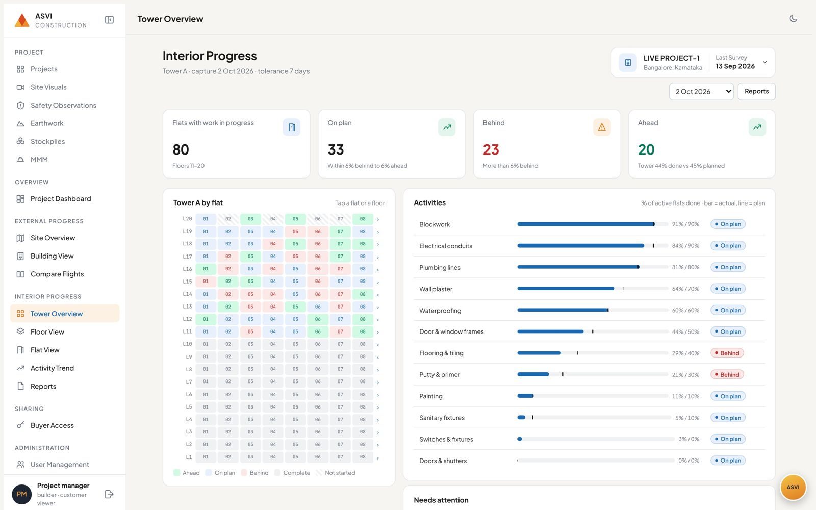
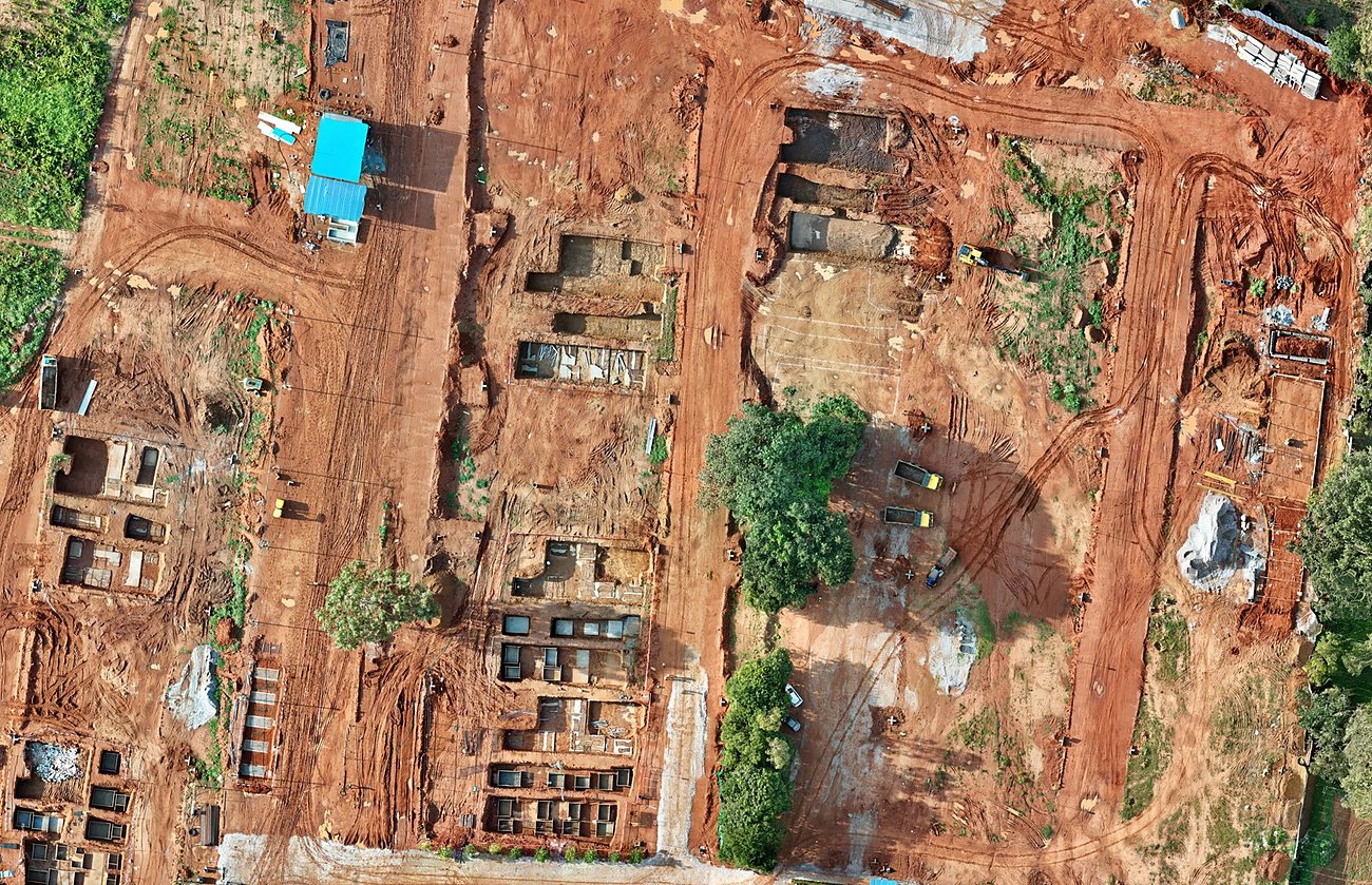
We Capture It. We Verify It. We Tell Your Buyers.
No cameras for your staff to carry, no software for them to learn. Our fleet, our crew and our analysts deliver the whole cycle, from the first flight to the update your buyer opens on their phone.
Our Drones & 360° Cameras
Licensed pilots fly every month; our crew walks every flat.
Our Analysts
Process, measure and check every finding against your plan.
Your Team Decides
Dashboards and reports with photo evidence, in 48 hours.
Your Buyers See Progress
Flat-level updates you choose to share, on your terms.
Independent Evidence For Every Decision On Site
Projects of every scale, from high-rise towers to expansive villa communities.
Billing Evidence
Measured earthwork and material volumes to verify contractor and supplier bills.
Progress Against Plan
Site-wide external and internal progress, tracked against your plans and drawings.
Men, Machines & Materials
Independent tracking to improve accountability and reduce leakage.
Engage Buyers & Strengthen Brand
Share 360° walkthroughs and progress updates with buyers, on your terms.
Know Every Site Without Being There
For builders and project leaders managing sites across cities: a clear, verified picture of every project, every review cycle.
Eyes In The Sky
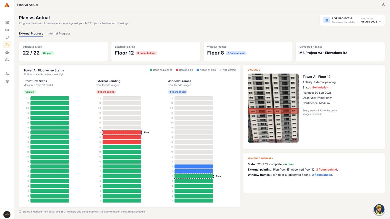
Drone surveys of every tower, slab, stockpile and boundary. External progress of structure and façade, measured floor by floor against your schedule.
Facts On The Ground
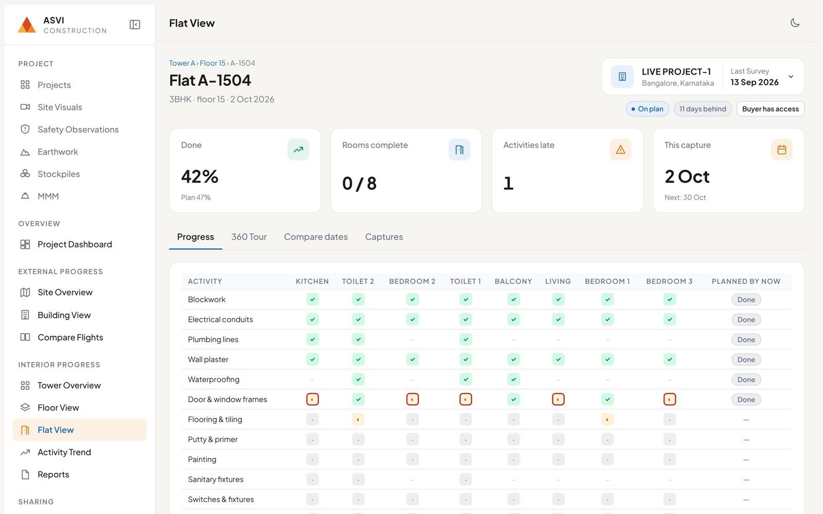
Our crew walks every flat in progress and captures every fact. Internal progress of finishing works, room by room, so you see which activity is late before it costs you.
At Your Fingertips
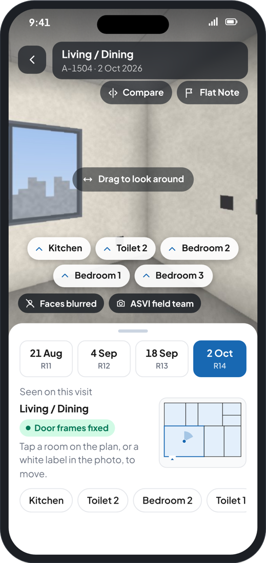
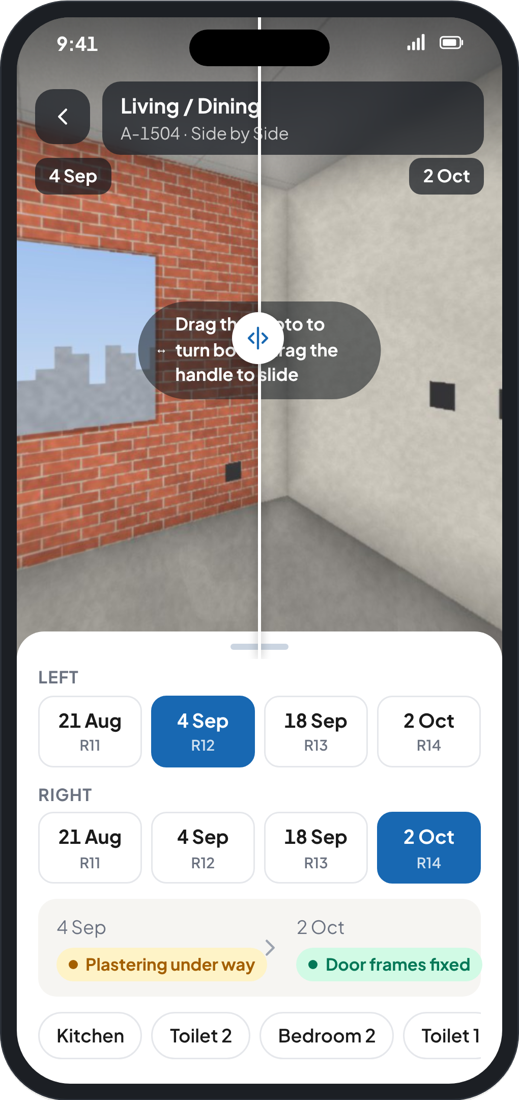
On-demand reports, dashboards and 360° site walkthroughs. Share progress with buyers on your terms, with faces blurred and every date side by side.
One Record Everyone Can Trust
Every Kind Of Site, Seen In Full Detail
High-Rise Towers
Three 22-floor residential towers: slab cycle recorded on every tower, façade painting tracked as it rises, basement and site works mapped each month.
Villa Communities
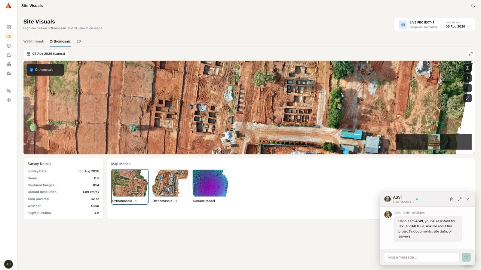
A 32-acre villa development mapped end to end: every footing, stockpile and hazard pinned on an annotated site map, with villa rows tracked as they rise.
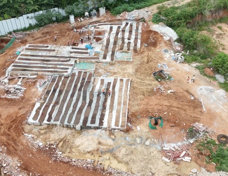
Compact Builds
Project marketing office and demo flat construction: grade slab, steel fabrication, stored wall panels and underground works all captured, measured and reported.
Site figures from monthly surveys of live construction projects, Aug to Oct 2026.
From Flight To Decision
Capture
Planned, DGCA-compliant drone missions every month, plus 360° capture inside.
Process
Orthomosaic, 3D model and elevation data.
Analyse
Volumes, progress, men, machines, materials and exceptions.
Compare
Progress checked against your drawings and schedule.
Publish
Within 48 hours of capture, with photo evidence for every finding.
Act
Billing approvals and corrective action backed by evidence.
Easy To Start, Safe To Trust
Your Data Stays In India
Hosted in Google Cloud's India data centre.
Published In 48 Hours
From capture to your dashboard, every round.
Confidential By Design
Separate data for every company, role-based access, NDA on request.
Zero Site Burden
Our drones, licensed pilots and 360° crew, following your site safety rules.
One-Time Setup
Share your drawings and schedule once; we configure everything.
Low-Risk Start
A paid pilot. Your pilot fee is fully credited towards your annual contract.
The Same Platform For Other Large Sites
Mining
Every tonne measured, every bench seen: stockpile, excavation and overburden volumes, stock reports and compliance evidence.
Agriculture
Every tree counted, every acre seen: plant counts, gap maps, crop health maps and measured acreage.
Industrial Parks & Campuses
Your whole campus, mapped and monitored: base maps, asset registers, inspection reports and plot-by-plot status.
We Also Build Software For The AI Era
The engineering team behind ASVI builds AI-enabled products for other businesses.
See Your Site As It Really Is.
Book a demo and site introduction today: pilot within 2 weeks.