
Construction Site Intelligence.
In The Sky. On The Ground. At Your Fingertips.
We survey your site from the air, walk every flat in progress on the ground, and put independent, objective evidence for billing, progress, safety and decision-making at your fingertips.
Powered by ASVI – Visual Intelligence Platform
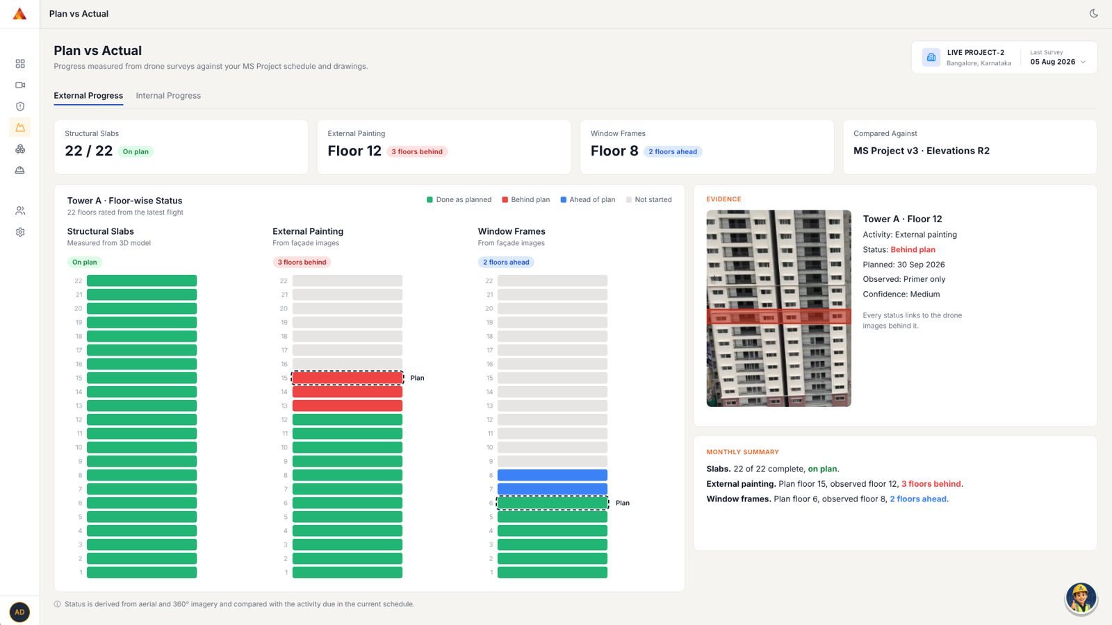
Every Tower, Floor & Activity, Against Your Schedule
Structure and façade, measured from the air every round and compared with your drawings and programme.
Share Your Plan Once
Elevations and project schedule; MS Project and other common formats.
Track every tower, floor and activity
Each survey shows status as Ahead, On Plan or Behind.
Verify With Visual Evidence
Slab progress from the 3D model; façade painting and windows from close-range images.
Villas And Plotted Layouts Too
Unit by unit, every status backed by dated drone images.
How Progress Tracking Works
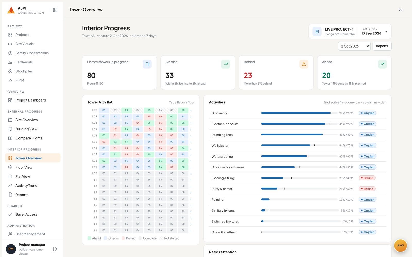
Every Flat. Every Room. Progress Against Plan.
Finishing works, captured in 360° by our crew and checked room by room against your schedule.
Flat-by-flat progress
Status of every flat, floor and tower, with delayed flats highlighted first.
Room-by-room activity tracking
From blockwork and electrical work to painting and fixtures.
Evidence-backed reporting
Dated 360° imagery and activity observations behind every status.
From Tower To Flat, In One View
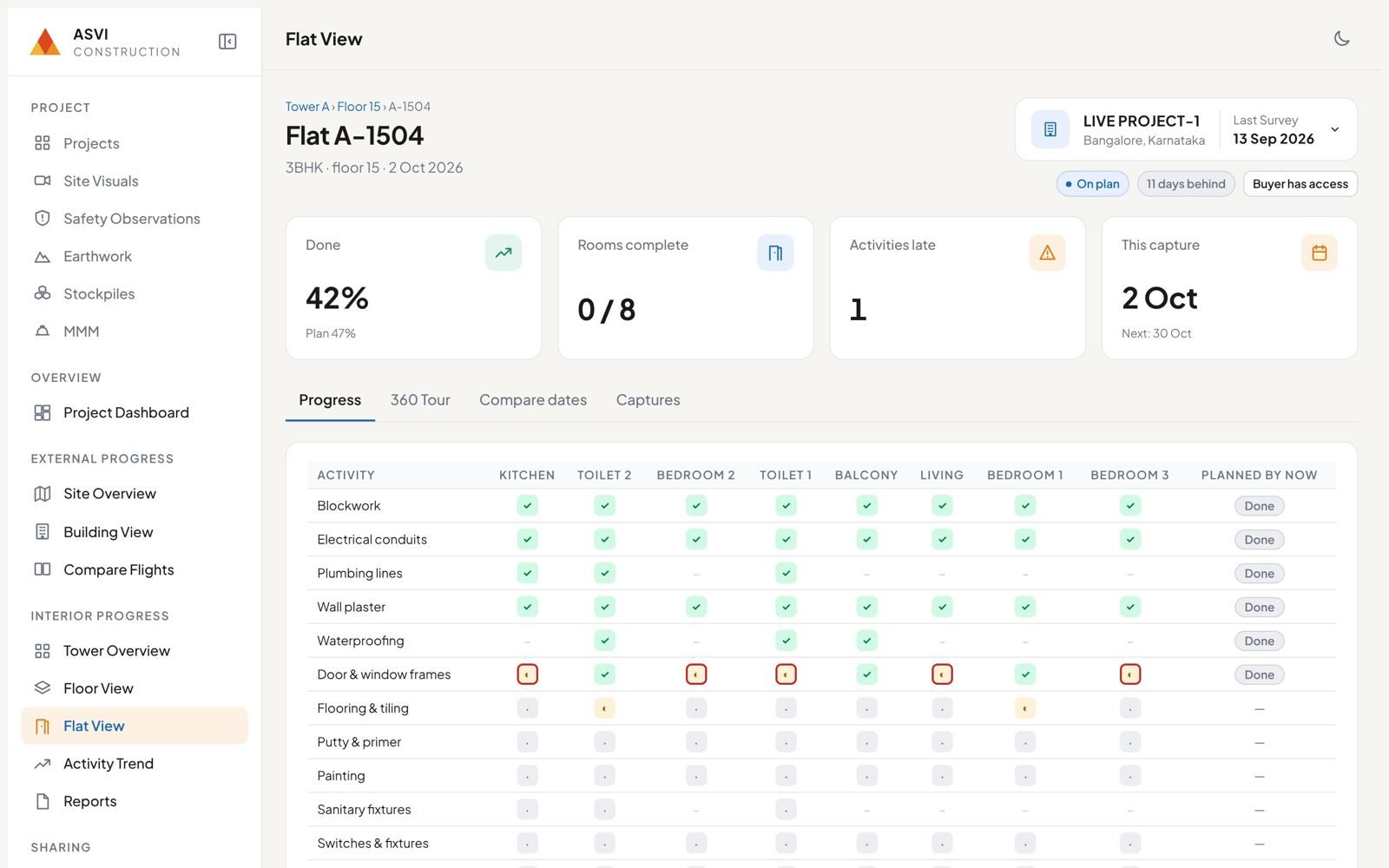
Drill down from the tower view to an individual flat to see the status of every room and activity.
From Aerial Data To Measurable 3D Models
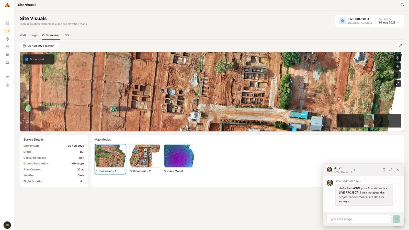
Explore The Site
Interactive site map with orthomosaic and 3D model for a clear, measurable view of the entire site.
- —Orthomosaic and 3D model of the whole site
- —Cut and fill, stockpiles and excavation areas
- —Changes between survey rounds
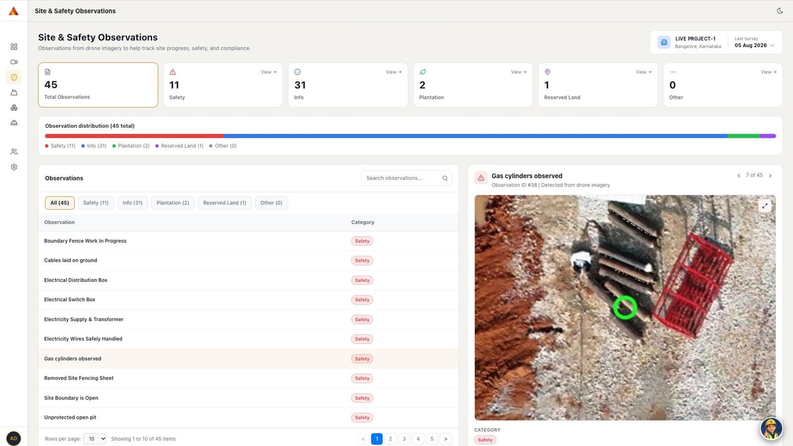
Every Observation Categorised
All site observations, clearly categorised and linked to drone images.
- —Photo evidence for every observation
- —Open, in progress or resolved, with priorities
- —Pinned to the exact spot on the map
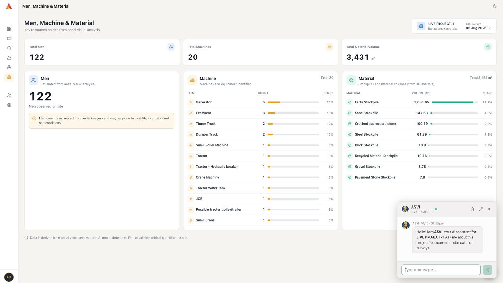
Men, Machines & Materials
Independent tracking of manpower, machinery and material stockpiles.
- —Counts with visual evidence
- —Changes across survey rounds
- —Better accountability, less leakage
Illustrative Data
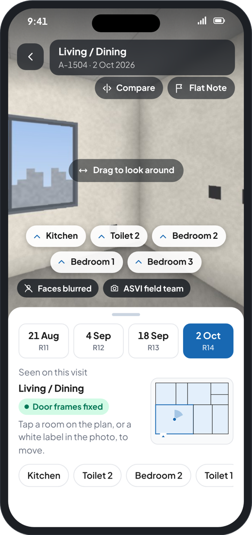
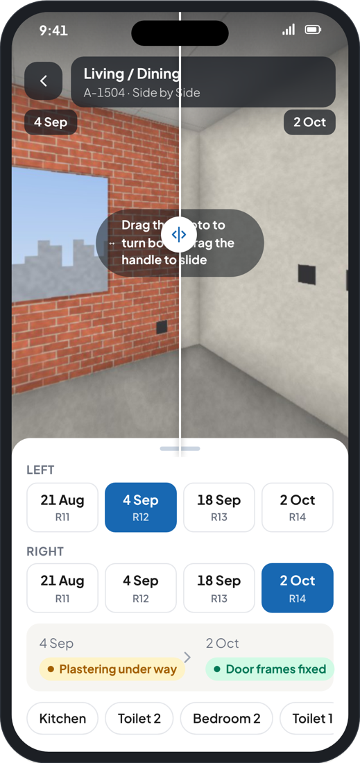
Share Progress With Buyers, On Your Terms
- You decide when and what to share. Each round, and which towers or flats are visible.
- Only buyers on your list sign in, with a one-time code to their registered mobile or email.
- Each buyer sees only their own flat, with a 360° tour of every capture.
- Photos, not numbers. No schedule details or delay information.
- Faces blurred before sharing. Updates stay exactly as captured.
Illustrative Data
Today Versus With ASVI
Everything You Need, After Every Survey
3D Models & Maps
Orthomosaic and measurable 3D model; annotated site map with observations pinned.
Progress & Quantities
Progress against schedule; earthwork and stockpile volumes; men, machines and materials counts.
Visual Evidence
Dated photo log of observations; aerial walkthrough video; 360° site walkthroughs where captured.
Reports & Access
Web platform access; downloadable reports; comparison with previous rounds; critical issues with recommended actions.
Pick The Capabilities You Need
Delivered as a managed service: we capture, process, analyse and publish the agreed outputs. Choose any combination for each site.
Capture & Measure
From the air, across the whole project boundary.Aerial Capture And Orthomosaic
DGCA-compliant flights, site map with DTM, DSM and 0.5 m contours, and an annotated report.
Earthwork And Stockpile Volumes
Cut, fill and stockpile quantities across the project boundary.
Aerial Walkthrough Video
1–2 minute edited aerial walkthrough video.
Progress Against Plan
Every tower, floor, flat and room against your schedule.3D Model
Measurable 3D building models, covering the full height of buildings.
External Progress vs Plan
Structure & façade: tower, floor and activity status against drawings and the MS Project schedule.
Internal Progress vs Plan
Finishing works: 360° capture of flats, room by room against the schedule.
Platform & Buyers
Your evidence online, and shared on your terms.ASVI Cloud Platform
Web platform with reports, maps, observations and survey history.
Buyer Updates
Controlled sharing of each flat's 360° walkthrough with its registered buyers.
Project Onboarding
Your drawings, schedules and documents configured for the selected modules.
From First Conversation To Monthly Monitoring
Demo & Site Introduction
Understand your site conditions and agree on focus areas.
Pilot
One capture at standard rates, with a full report and platform access for one live site.
Review
Evaluate results against agreed success criteria.
Annual Contract
Recurring monitoring for your selected sites.
Your pilot fee is fully credited towards your annual contract.
Eyes In The Sky. Facts On The Ground. Information At Your Fingertips.
Book a demo and site introduction today: pilot within 2 weeks.